My spouse and I are on vacation in Japan, spending half our time seeing the sights and the other half working remotely and enjoying the experience of living in a different place for a while. To get here, we flew on British Airways from London to Tokyo, and I entertained myself on the long flight by browsing the interactive flight map on the back of my neighbor’s seat and trying to figure out how the poor developer who implemented this map solved the thorny problems that displaying a world map implies.
I began my survey by poking through the whole interface of this little in-seat entertainment system1 to see if I can find out anything about who made it or how it works – I was particularly curious to find a screen listing open source licenses that such such devices often disclose. To my dismay I found nothing at all – no information about who made it or what’s inside. I imagine that there must be some open source software in that thing, but I didn’t find any licenses or copyright statements.
When I turned my attention to the map itself, I did find one copyright statement, the only one I could find in the whole UI. If you zoom in enough, it switches from a satellite view to a street view showing the OpenStreetMap copyright line:
Given that British Airways is the proud flag carrier of the United Kingdom I assume that this is indeed the only off-the-shelf copyrighted material included in this display, and everything else was developed in-house without relying on any open source software that might require a disclosure of license and copyright details. For similar reasons I am going to assume that all of the borders shown in this map are reflective of the official opinion of British Airways on various international disputes.
As I briefly mentioned a moment ago, this map has two views: satellite photography and a very basic street view. Your plane and its route are shown in real-time, and you can touch the screen to pan and zoom the map anywhere you like. You can also rotate the map and change the angle in “3D” if you have enough patience to use complex multitouch gestures on the cheapest touch panel they could find.
The street view is very sparse and only appears when you’re pretty far zoomed in, so it was mostly useless for this investigation. The satellite map, thankfully, includes labels: cities, country names, points of interest, and, importantly, national borders. The latter are very faint, however. Here’s an illustrative example:
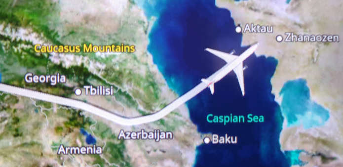
We also have our first peek at a border dispute here: look closely between the “Georgia” and “Caucasus Mountains” labels. This ever-so-faint dotted line shows what I believe is the Russian-occupied territory of South Ossetia in Georgia. Disputes implicating Russia are not universally denoted as such – I took a peek at the border with Ukraine and found that Ukraine is shown as whole and undisputed, with its (undotted) border showing Donetsk, Luhansk, and Crimea entirely within Ukraine’s borders.
Of course, I didn’t start at Russian border disputes when I went looking for trouble. I went directly to Palestine. Or rather, I went to Israel, because Palestine doesn’t exist on this map:
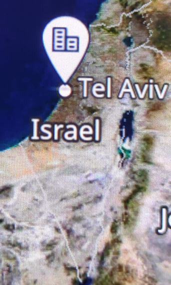
I squinted and looked very closely at the screen and I’m fairly certain that both the West Bank and Gaza are outlined in these dotted lines using the borders defined by the 1949 armistice. If you zoom in a bit more to the street view, you can see labels like “West Bank” and the “Area A”, “Area B” labels of the Oslo Accords:
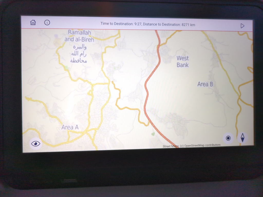
Given that this is British Airways, part of me was surprised not to see the whole area simply labelled Mandatory Palestine, but it is interesting to know that British Airways officially supports the Oslo Accords.
Heading south, let’s take a look at the situation in Sudan:
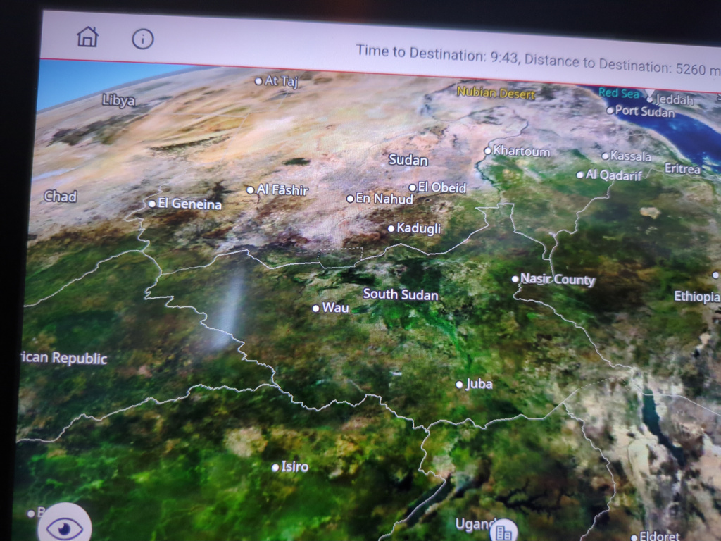
This one is interesting – three areas within South Sudan’s claimed borders are disputed, and the map only shows two with these dotted lines. The border dispute with Sudan in the northeast is resolved in South Sudan’s favor. Another case where BA takes a stand is Guyana, which has an ongoing dispute with Venezuela – but the map only shows Guyana’s claim, albeit with a dotted line, rather than the usual approach of drawing both claims with dotted lines.
Next, I turned my attention to Taiwan:
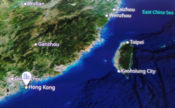
The cities of Taipei and Kaohsiung are labelled, but the island as a whole was not labelled “Taiwan”. I zoomed and panned and 3D-zoomed the map all over the place but was unable to get a “Taiwan” label to appear. I also zoomed into the OSM-provided street map and panned that around but couldn’t find “Taiwan” anywhere, either.
The last picture I took is of the Kashmir area:
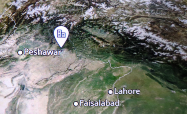
I find these faint borders difficult to interpret and I admit to not being very familiar with this conflict, but perhaps someone in the know with the patience to look more closely will email me their understanding of the official British Airways position on the Kashmir conflict (here’s the full sized picture).
Here are some other details I noted as I browsed the map:
- The Hala’ib Triangle and Bir Tawil are shown with dotted lines
- The Gulf of Mexico is labelled as such
- Antarctica has no labelled borders or settlements
After this thrilling survey of the official political positions of British Airways, I spent the rest of the flight reading books or trying to sleep.
-
I believe the industry term is “infotainment system”, but if you ever catch me saying that with a straight face then I have been replaced with an imposter and you should contact the authorities. ↩︎